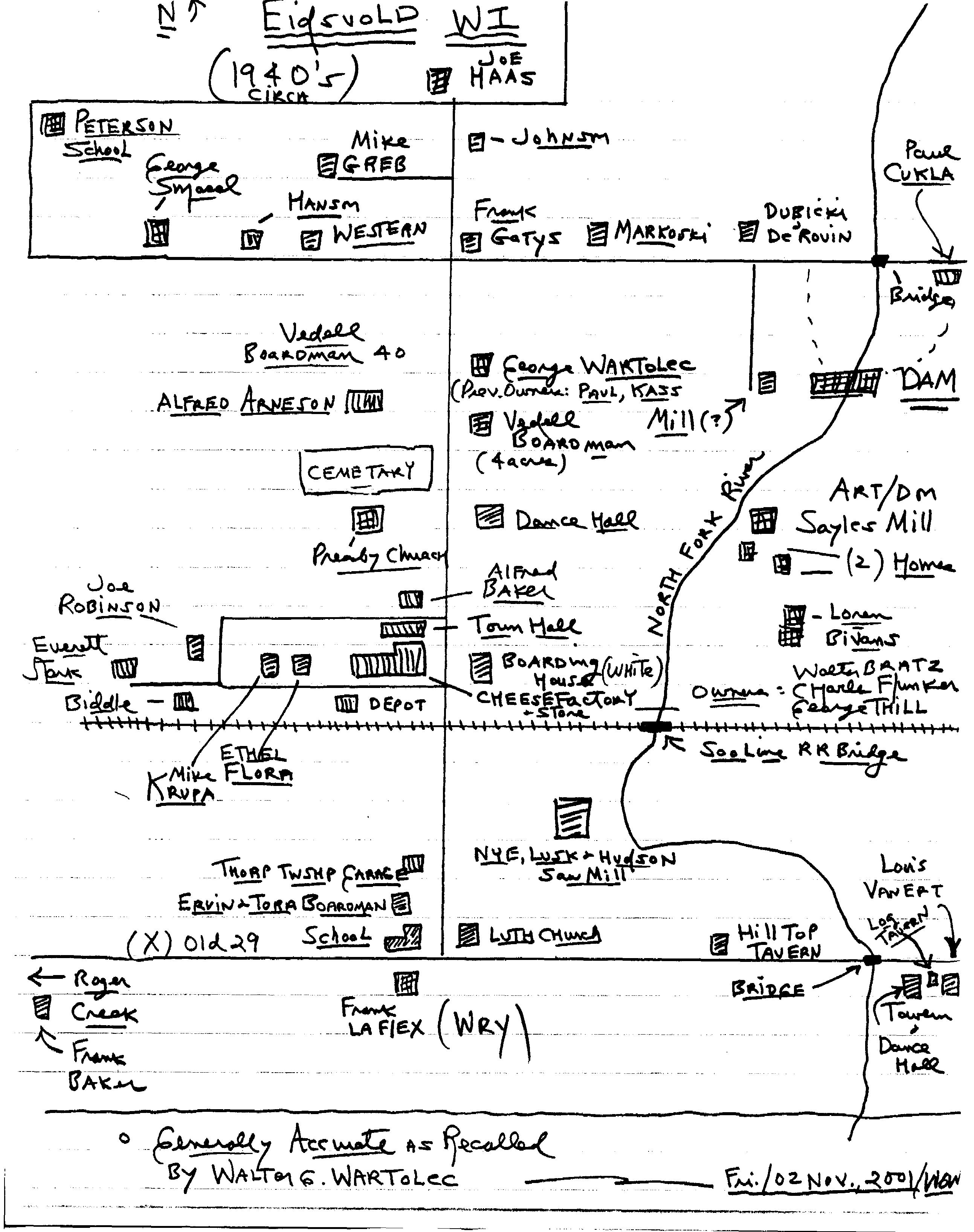
Eidsvold Sketch Map - 1940s
This map and recollection has been provided by Walter Wartolec
click here to download a larger
version of this map (about 1 MB)
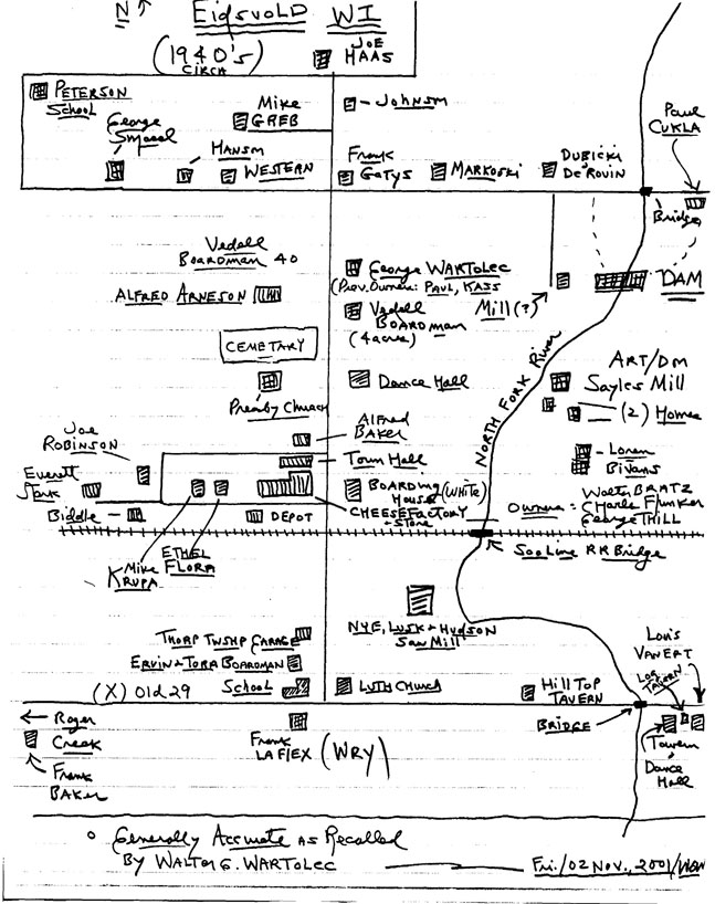 |
Eidsvold Sketch Map
Provided by Walter Wartolec
This is a sketch of the Village of Eidsvold in the 1940’s as recollected
by Walter Wartolec. The sketch represents the western portion of Section
27 and the eastern portion of Section 28 of the Township of Thorp.
Portions of Sections 21 & 22 are on the north, and Sections 33 & 34 to
the south of old Highway 29.
North East portion, left to right: Johnson farm, Frank Gatys, Markoski,
Dubicki and DeRouin.
East Central portion, left to right and north to south: Paul Cukla farm,
George Wartolec farm (previous ovrs Paul & Kass), Mill?, Rapids Dam, the
Vedell Boardman 4 acre homestead, dance hall, Art Sayles saw mill east
of the North Fork River with their two homes, Loren Bivans farm,
Eidsvold Boarding House (previous owners N. A. Hazen and White).
South East portion: Soo Line bridge over the North Fork, Nye, Lusk &
Hudson Saw Mill, Lutheran Church, Hill Top Tavern, old Highway 29
bridge, tavern and dance hall, Louis Van Ert’s.
South West portion (lef to right, south to north): The annotation “Roger
Creek” refers to the school which is located approximately 1 mile west,
Frank Baker’s farm, Frank LaFlex farm (previous owner A. L. Wry);
Eidsvold State Graded School, Ervin & Tora Boardman farm, Thorp Township
Garage.
West portion (Eidsvold): Everett Stark, Biddle, Joe Robinson, Mike Krupa,
& Ethel Flora homes, Railroad Depot, cheese factory (owners Walter Bratz,
Charles Flunker & George Thill), Town Hall, Alfred Baker, Presbyterian
Church, Eidsvold Cenetery, Alfred Arneson, & Vedell Boardman farm.
North East portion: Peterson School, and George Smasal, Hanson, Western,
Mike Greb & Joe Haas farms.
|
|
|
|