Bio:
Tuttle, Samuel -1792 Land Records
Contact: Stan
----Source:
Contributed by Janet
Schwarze, transcribed by James P.
Tuttle.
Surnames:
1792 Land Record of Samuel Tuttle
(Click on the document to enlarge it)
Watertown October 3, 1792
Thus laid out to Samuel Tuttle two pieces of
The other piece ??? as ??? northward the first piece
Rec’d to Record Hon Aaron Matthews ???
Dec 28th, 1792
Recorded H.?. Wright ???
Transcribed as it appears on the original document located at
Watertown, Connecticut by James P.
Tuttle on August 19, 2007. © Every submission is protected by the Digital Millennium Copyright Act
of 1998. Show your appreciation of this freely provided information by not
copying it to any other site without our
permission.
Become a Clark County History
Buff
A site created and
maintained by the Clark County History Buffs
Webmasters: Leon
Konieczny, Tanya Paschke,
Janet & Stan Schwarze, James W. Sternitzky, 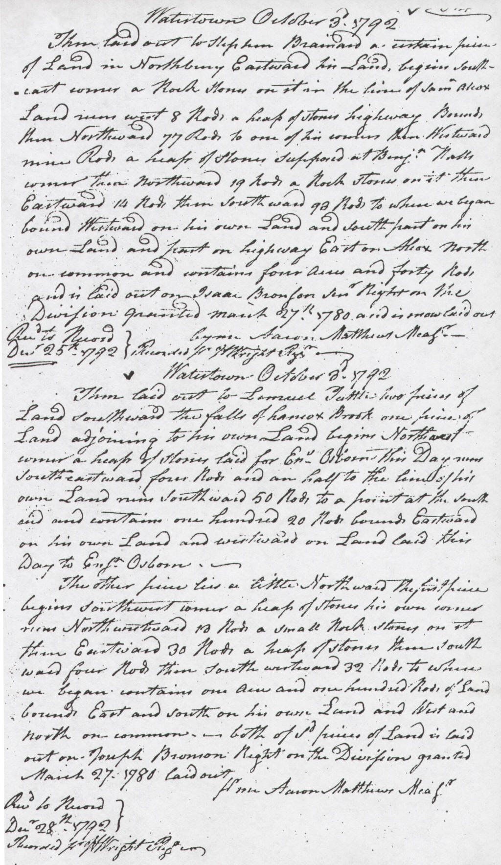
land southward the falls of Lamox Brook one piece of
land adjoining to his own land begins northwest
corner a heap of stones laid for E[???] Osborn this day ???
southeastward four rods and then half to the line of his
own land runs southward 50 rods to a point at the south
said ??? contains one hundred 20 rods bound eastward
on his own land and westward on land laid this
day to E[???] Osborn.
begins southwest corner a heap of stones his own ???
??? northwestward 10 rods a small rock stones on it
then eastward 30 rods a heap of stones then south
ward four rods then southwestward 32 rods to where
we began. Contains one acre and one hundred rods of land
bounds east and south on his own land and west and
north on common. Both of s’d pieces of land is laid
out on Joseph Bronson Right on the Division granted
March 27, 1780 laid out.
![]()
and supported by your generous donations.