|
Lynn Line Bridge Replacement
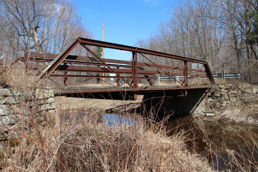
Lynn Line Bridge (viewed from the South side).
Contributed by Ms. Erin Kelly, Cultural Resource Specialist, Mead &
Hunt.
The Wisconsin Department of Transportation will be replacing the Lynn Line Road Bridge (also known as the Fairhaven Bridge). The bridge crosses the East Fork Black River at the eastern border of Lynn Township in Clark County and western border of Rock Township in Wood County. The road south of the bridge is named Lynn Line Road. The road north of the bridge continues as Lynn Line Road for about 1.5 miles, and then it is named Fairhaven Road. The bridge is about 8.7 miles southeast from the Town of Lynn. It is easiest to find if you start from Lindsey in Wood County: go west on Starr Road about 7 tenths of a mile. Go two miles south on Fairhaven Road. Note: the street sign at Lindsey identifies the road as Starr Road. Google maps identifies it as Lindsey Drive from the Lindsey Community to Fairhaven Road.
The original bridge was built in 1906. It was closed to traffic before 1994 because of its condition. In 2021, the Lynn Line Road Bridge met the criteria to be eligible for the National Register of Historic Places in Wisconsin because of its engineering design. See the linked document for the history, design, map and additional photographs the old bridge at DOT_Lynn_Line_Road_Bridge.pdf.
A detailed construction design for the new bridge is available from the Wisconsin DOT webpage at https://wisconsindot.gov/hccidocs/bid-let/2023/20230314/plans-proposals/20230314030plan.pdf.
A webpage regarding the Lynn Line Road bridge includes a map and
photographs of the bridge. That webpage identifies the geographical coordinates
for the bridge as
44°31'38" N, 90°18'56" W. See
https://bridgehunter.com/wi/wood/P71091400000000/. Return to the Lynn Township History Webpage Return to the Lynn Township Homepage The contact for this webpage is James W. Sternitzky PhD
|